Skip to content
Holopaw, FL

Parcel Search. Suburban Estates

Look up property owners and parcel numbers for all parcels in Suburban Estates, Holopaw, FL. Free. No account required.

Holopaw, FL, Osceola County, FL·~11,000-acre community·Typical lot: 0.3 to 1.25 acres
Showing 1609–1632 of 8,711 parcels
112731000031240030INGLE TIMOTHY JHOLOPAW GROVES RD, SAINT CLOUD112731000031240040INGLE TIMOTHY JASONHOLOPAW GROVES RD, SAINT CLOUD112731000031240050GONZALEZ REYES MARCOS JAVIERHOLOPAW GROVES RD, SAINT CLOUD112731000031240060METAMETA LLCHOLOPAW GROVES RD, SAINT CLOUD112731000031240070METAMETA LLCHOLOPAW GROVES RD, SAINT CLOUD112731000031240080METAMETA LLCHOLOPAW GROVES RD, SAINT CLOUD112731000031310010METAMETA LLCHOLOPAW GROVES RD, SAINT CLOUD112731000031310020COOPER ROSEHOLOPAW GROVES RD, SAINT CLOUD112731000031330020RUSSELL MICHAEL RAYHOLOPAW GROVES RD, SAINT CLOUD112731000031340010TONEY A MHOLOPAW GROVES RD, SAINT CLOUD112731000031340020ALLI SHAHABUDIN J RHOLOPAW GROVES RD, SAINT CLOUD112731000031410000LAM TOMHOLOPAW GROVES RD, SAINT CLOUD112731000031420010MILLER FAMILY REVOCABLE LIVINGHOLOPAW GROVES RD, SAINT CLOUD112731000031420020PODHAJSKY DALE JHOLOPAW GROVES RD, SAINT CLOUD112731000031430010EDGE DELBERT RHOLOPAW GROVES RD, SAINT CLOUD112731000031430020LUBIN YVES MHOLOPAW GROVES RD, SAINT CLOUD112731000031440010WEBSTER KENNETHHOLOPAW GROVES RD, SAINT CLOUD112731000031440020RONALD B & BARBARA L BERGUM REHOLOPAW GROVES RD, SAINT CLOUD112731000032110010VIDULICH RAYMOND JHOLOPAW GROVES RD, SAINT CLOUD112731000032110020BE A MAN BUY LAND LLCHOLOPAW GROVES RD, SAINT CLOUD112731000032120010HAISLIP WILLIAM EHOLOPAW GROVES RD, SAINT CLOUD112731000032120020FEIERABEND SIEGFRIED PAULHOLOPAW GROVES RD, SAINT CLOUD112731000032120030PHILPOT SAMANTHA KAYHOLOPAW GROVES RD, SAINT CLOUD112731000032120040RODRIGUEZ SEBASTIAN ANTONIOHOLOPAW GROVES RD, SAINT CLOUD

Page 68 of 363

1609–1632 of 8,711

About Holopaw, FL Parcel Records

Suburban Estates is located roughly 50 miles south of Orlando in Osceola County. The community contains thousands of individual parcels, typically 0.3 to 1.25 acres of raw land.

Parcel data shown here comes from Osceola County public GIS records. You can search by owner name (last name works best) or by parcel number. Each record shows the owner of record, mailing address, physical address, acreage, assessed value, and legal description.

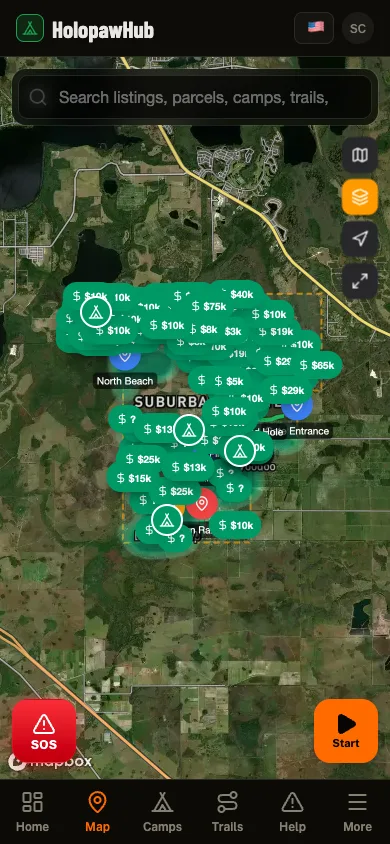
Need to see parcel boundaries on a map? The free Holopaw Hub app shows every parcel boundary overlaid on satellite imagery. Tap any lot to see owner details, record a trail, or check fire alerts. No subscription required.

See every parcel on a satellite map

The Holopaw Hub app shows every parcel boundary on satellite imagery. Tap any lot for owner details, fire alerts, and community features. Completely free.

Get the App. It's Free