Skip to content
Holopaw, FL

Parcel Search. Suburban Estates

Look up property owners and parcel numbers for all parcels in Suburban Estates, Holopaw, FL. Free. No account required.

Holopaw, FL, Osceola County, FL·~11,000-acre community·Typical lot: 0.3 to 1.25 acres
Showing 4657–4680 of 8,711 parcels
19273200004223002FOCONNOR ELLEN M ESTHOLOPAW GROVES RD, SAINT CLOUD19273200004224001FBE A MAN BUY LAND LLCHOLOPAW GROVES RD, SAINT CLOUD19273200004224002FSTELLATO MICHELHOLOPAW GROVES RD, SAINT CLOUD19273200004231000FRAFEEK MOHAMED SAHIDHOLOPAW GROVES RD, SAINT CLOUD19273200004232002FKINTAZIS CHARLESHOLOPAW GROVES RD, SAINT CLOUD19273200004233000FGREEN JOSEHOLOPAW GROVES RD, SAINT CLOUD19273200004233001FHAMNER HAILEEHOLOPAW GROVES RD, SAINT CLOUD19273200004233002FSHOWERS TAYLORHOLOPAW GROVES RD, SAINT CLOUD19273200004233003FGONZALEZ ANGEL DAVIDHOLOPAW GROVES RD, SAINT CLOUD19273200004233004FJONES MICHAELHOLOPAW GROVES RD, SAINT CLOUD19273200004233005FSESTO JAVIERHOLOPAW GROVES RD, SAINT CLOUD19273200004233006FBEAUCHENE JENNIFERHOLOPAW GROVES RD, SAINT CLOUD19273200004233007FSLOANE TRAVISHOLOPAW GROVES RD, SAINT CLOUD19273200004234000FCRUZ BOTELLO SHAYLIN FHOLOPAW GROVES RD, SAINT CLOUD19273200004234001FMAGRAY MIKE LHOLOPAW GROVES RD, SAINT CLOUD19273200004242001FBOOTH JOHN JHOLOPAW GROVES RD, SAINT CLOUD19273200004242002FABLES BRAD EHOLOPAW GROVES RD, SAINT CLOUD19273200004242003FSIMI LAND HOLDINGSHOLOPAW GROVES RD, SAINT CLOUD19273200004242004FCRUZ AIDEHOLOPAW GROVES RD, SAINT CLOUD19273200004242005FBAEZ KENNETH AHOLOPAW GROVES RD, SAINT CLOUD19273200004243000FLAGASSE LILLIAN VON HOVENHOLOPAW GROVES RD, SAINT CLOUD19273200004311000FLUCIER VICTOR MHOLOPAW GROVES RD, SAINT CLOUD19273200004312001FSCOTT CASEY JHOLOPAW GROVES RD, SAINT CLOUD19273200004312002FLEWIN PEARL TRHOLOPAW GROVES RD, SAINT CLOUD

Page 195 of 363

4657–4680 of 8,711

About Holopaw, FL Parcel Records

Suburban Estates is located roughly 50 miles south of Orlando in Osceola County. The community contains thousands of individual parcels, typically 0.3 to 1.25 acres of raw land.

Parcel data shown here comes from Osceola County public GIS records. You can search by owner name (last name works best) or by parcel number. Each record shows the owner of record, mailing address, physical address, acreage, assessed value, and legal description.

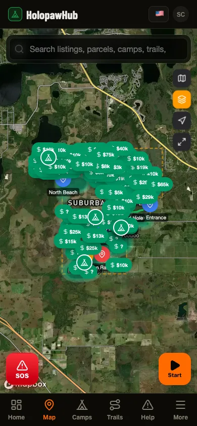
Need to see parcel boundaries on a map? The free Holopaw Hub app shows every parcel boundary overlaid on satellite imagery. Tap any lot to see owner details, record a trail, or check fire alerts. No subscription required.

See every parcel on a satellite map

The Holopaw Hub app shows every parcel boundary on satellite imagery. Tap any lot for owner details, fire alerts, and community features. Completely free.

Get the App. It's Free