Parcel Search
25273199930411004E
LASSALLE SONIA N
Holopaw, FL, Osceola County, FL0.34 acres
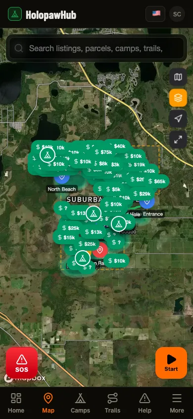
262 neighboring parcels · 7 landmarksOpen this area in the app
Acreage
0.34 acres
Assessed Value
$700
Property Details
- Parcel ID
- 25273199930411004E
- Owner
- LASSALLE SONIA N
- Property Address
- HOLOPAW GROVES RD, SAINT CLOUD
- Acreage
- 0.34 acres
- Assessed Value
- $700
- Township-Range-Section
- 27S-31E-25
Legal Description
BEG 1517.36 FT S OF NE COR OF
Also Owned by LASSALLE SONIA N
20 other parcels in Suburban Estates
19273200003444002FHOLOPAW GROVES RD, SAINT CLOUD1.26 acres$1,80019273200004432002FHOLOPAW GROVES RD, SAINT CLOUD1.26 acres$1,80025273100003331007DHOLOPAW GROVES RD, SAINT CLOUD0.31 acres$70025273199910121005EHOLOPAW GROVES RD, SAINT CLOUD0.31 acres$70025273199910121006EHOLOPAW GROVES RD, SAINT CLOUD0.31 acres$70025273199910121007EHOLOPAW GROVES RD, SAINT CLOUD0.31 acres$70025273199920111025EHOLOPAW GROVES RD, SAINT CLOUD0.31 acres$70025273199920241001EHOLOPAW GROVES RD, SAINT CLOUD0.31 acres$70025273199950232001EHOLOPAW GROVES RD, SAINT CLOUD1.24 acres$1,80026273100001121003CHOLOPAW GROVES RD, SAINT CLOUD1.24 acres$1,80030273260001331001GHOLOPAW GROVES RD, SAINT CLOUD0.31 acres$70030273260002142001GHOLOPAW GROVES RD, SAINT CLOUD0.31 acres$70030273260002142008GHOLOPAW GROVES RD, SAINT CLOUD0.31 acres$70030273260002142009GHOLOPAW GROVES RD, SAINT CLOUD0.31 acres$70030273260002142010GHOLOPAW GROVES RD, SAINT CLOUD0.31 acres$70030273260002242001GHOLOPAW GROVES RD, SAINT CLOUD0.31 acres$70030273260002243001GHOLOPAW GROVES RD, SAINT CLOUD2.52 acres$3,60030273260002321001GHOLOPAW GROVES RD, SAINT CLOUD1.26 acres$1,80030273260002434002GHOLOPAW GROVES RD, SAINT CLOUD0.63 acres$1,00030273260002434003GHOLOPAW GROVES RD, SAINT CLOUD0.31 acres$700